
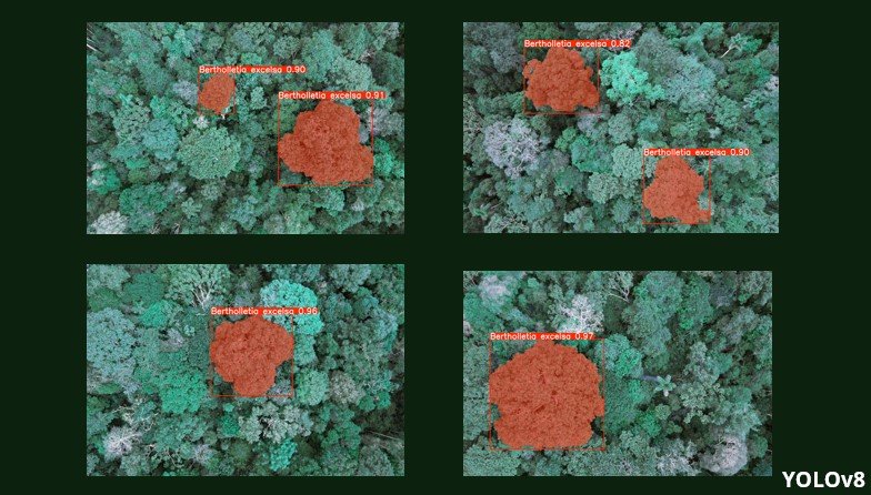
Mapping Brazil Nut Trees in the Amazon: How Drones and AI are Changing Conservation

Using 3D models in ArcGIS Pro to visualize buildings susceptible to sea level rise.
Using 3D models in ArcGIS Pro to visualize buildings susceptible to sea level rise.
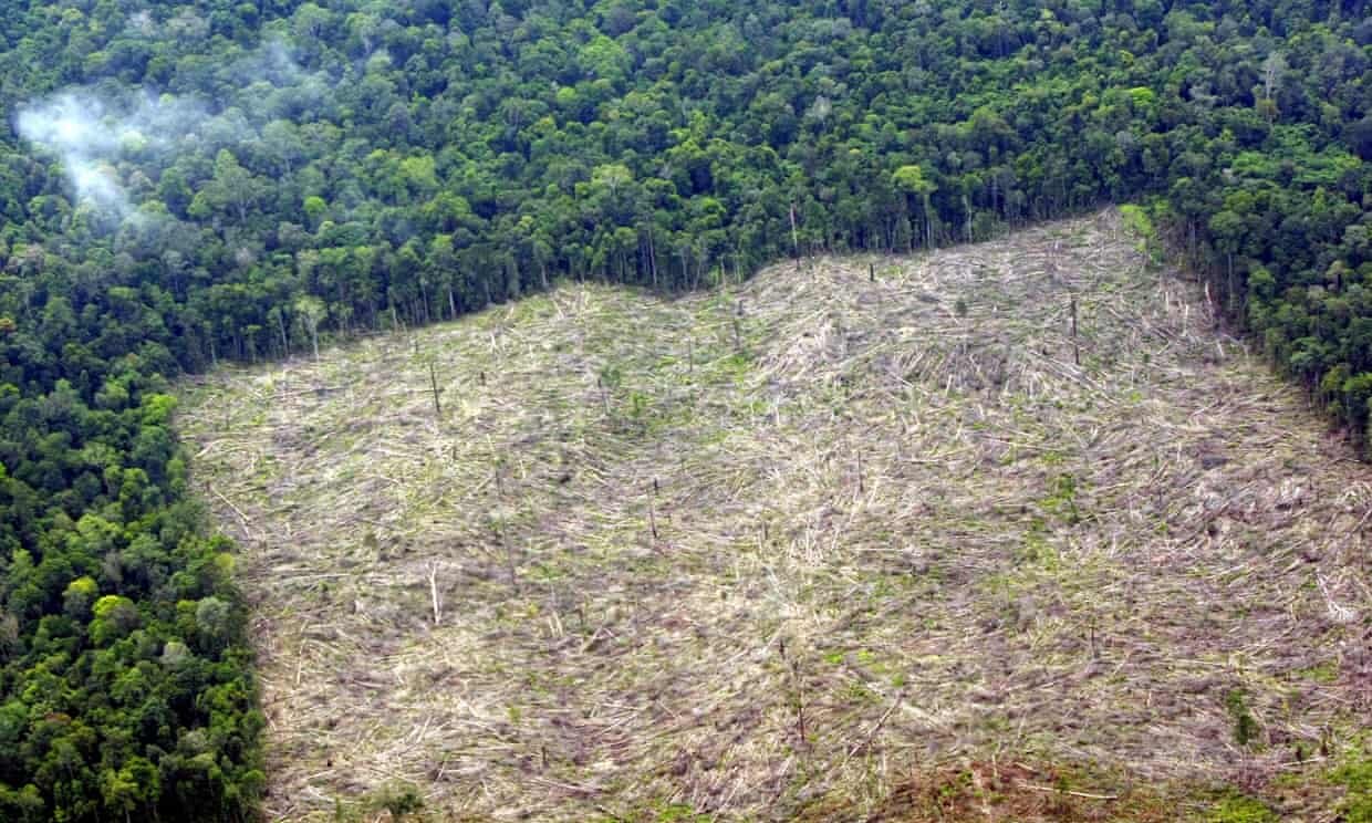
GeoMundo: Automated detection of deforestation from satellite images

Calculating Howler Monkey troop position based on position bearing and distance

Assessing the contributing factors for animal mortality in coastal Ecuador
